Once the boundary of a wetland is delineated, the wetland’s “value” must be quantified per a Department of Ecology rating form. A wetland can be rated from Category I (highest value) to Category IV (lowest value). City and county ordinances identify how far away a project should remain from a wetland, per its Ecology rating. Wetlands with higher values have larger offset requirements, or “buffers.”
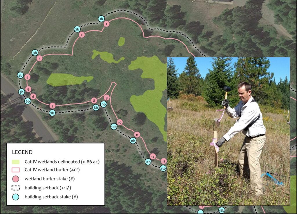
The buffer location is demarcated in the field with flagged stakes. In the figure above, you can see the mapped stake locations identifying the wetland’s Category IV buffer (40 ft) in addition to a building setback (+15 ft) as required by Kittitas County.
Once I have installed stakes, I geospatially record each stake with my GPS unit. Then, I send the spatial data and a hard copy sketch map to the Client and land survey crew. That way, the survey crew is sure to find the stakes in my absence (sometimes the brush is pretty thick).