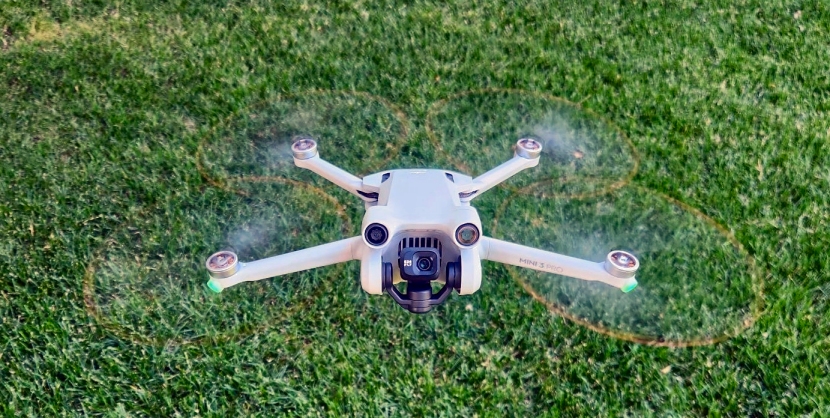
I want to give a shout out to my Pop!
A technology buff, he has long argued that I should add drone technology to the GG repertoire. I must admit that I was hesitant when he first brought it up. Work has been steady and I was concerned about a steep learning curve. Plus, I wasn’t convinced there was a significant enough niche in the market to warrant the time investment.
Well, Pop decided to support the business by giving me a nudge. He bought me a DJI Mini 3 Pro. Now that I am piloting it, I realized that, as a GPS geek who dabbles daily in GIS and mapping, a GPS-enabled drone that can shoot high-resolution photos and video fits into the GG ecosystem like a glove. Pop knows me well!
The question now is, how do I utilize the drone tech to further the mission of GG? I think the answer revolves primarily around product “diversification.” I’ve done wetland and ESA work for a long time; I still enjoy it.
However, my personality craves new challenges and hates dead time. Fieldwork is the backbone of most of my wetland deliverables – and that drops off in the winter. Without downhill skiing to keep me occupied, I’d probably go nuts. Drone work can fill in temporal gaps and also can be used to compliment my existing wetland work.
As I continue to mull over the future course for GG, I find the following potential uses for the drone intriguing:
- shooting photos and video for the real estate market;
- building orthomosaics for wetland delineations and habitat surveys;
- monitoring bird protection measures during bridge construction; and
- using quality imagery to improve this web site.
The goal is to be ready by 2024. In order to advertise drone products through GG, I must first pass the FAA Part 107 Aeronautical Knowledge Test and invest in the commercial drone software needed to capture and produce the work products I anticipate.
In the meantime, I’m having a ball learning how to fly the drone as a recreational pilot. It’s quite fun and when I use it to earn some income, it won’t feel like “work!”
Love you, Pop!

